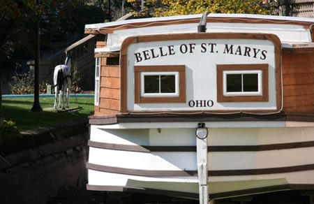


Ohio was only 21 years old as a state when the Ohio Legislature approved plans and authorized funding for an Ohio Canal system to be built. The year was 1825. This wasn't a spur of the moment decision on the legislature's part. In 1822 the legislature commission a study to test the feasibiliity survey to see if it would be possible to build canals throughout the state to connect to the major waterways namely the Ohio River and Lake Erie.

In 1820 there were estimated to be 580,000 residents then living in the state, and most of these were involved in agriculture. The problem with the modern agriculture of the day was that they had more produce than they could use. The best way to keep the family farm profitable was to sell the excess to places that didn't have so much agriculture.
Eight years earlier work had begun on building a canal that connected Lake Erie with the Hudson River and ultimately New York City. That opened lots of possibilities and the opportunity for Ohio's farmers and businessmen to sell their goods to a much larger market.

The Miami & Erie Canal was not initially conceived as a route from Lake Erie to the Ohio River. The Miami Canal was in operation from Middletown to Cincinnati in 1828, and in 1830, the 17 miles were completed to Dayton. The "Miami Extension" to Troy was not started until 1833. To satisfy political demands additional segments were parceled out to contractors until 1845 when the entire canal was open to traffic from the Ohio River to Lake Erie. The primary work force building the canal consisted of immigrants who worked for 30 cents a day, plus food, shelter and a shot of whiskey everyday.
The Miami-Erie Canal had 105 locks and was 250 mile long. Loramie Summit was the high point of the canal at 521 feet above th Ohio River and 395 feet above Lake Erie. Three man-made lakes (Indian Lake, Grand Lake, and Lake Loramie) were created to maintain water levels through parts of the canal.
The canal system reached its peak in revenue generation in 1855. At that time the Ohio canal system consisted of almost 1000 miles. It was at this time that railroads were becoming a cheaper and faster way of transporting goods across the country. The increased use of the rail system and later the highway system brought a slow death to the canal system. But it took a natural disaster to completely end the Ohio canal system in March of 1913 when Ohio experienced a record winter snowfall and then unusually heavy rains fell that caused widespread flooding throughout the state. This flooding destroyed many of the canal systems raised banks and locks. Ohio's canal system was dead.
Today less than 20% of the original canal system is still owned by the state and this is spread throughout the state in small plots of less than an acre. Recent interest in the canals has attracted the attention of small Ohio communities to use what remains of the canals as attractions.